This is a very specific problem with Generic Mapping Tools which I didn’t find well documented: if you map certain symbols to a list of coordinates specified in COORDINATES.xy, you can specify that subsets of those coordinates are mapped to symbols in different colors in two ways:
- You add a column containing numerical values that map to colors in
COLORS.cpt. This option is illustrated in my earlier post on making WALS maps. - You add coloring instructions directly to your
COORDINATES.xyfile by adding a line such as> -Gred. The hard-to-find part here was the fact that you need to prefix the color option by>.
In this case, your COORDINATES.xy file might look like this:
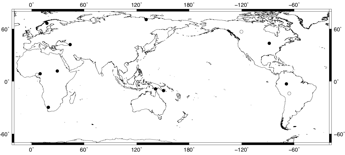
8.74, 9.72
11.80, 29.28
-8.65, 141.52
66.40, 17.43
70.67, 130.91
-29.71, 19.08
43.50, -88.50
-2.91, -68.91
42.04, 43.99
-10.61, 150.73
> -Gwhite -Wblack
56.80, -120.35
-13.81, -65.63
7.60, 6.04
> -Ggray -Wblack
-16.27, 168.01
-16.17, 168.14
-16.31, 168.05
-17.70, 168.38
-15.43, 167.24
You can then use this file, for example, with the following commands to produce a world map displaying these coordinates:
pscoast -R-20/340/-70/80 -Dl -A100/0/1 -JQ9.5i -W -B -K > MAP.ps
psxy COORDINATES.xy   -R -J -O -Sc0.25c -i2,1 -Gblack >> MAP.ps
The result looks like this: